| dc.contributor.author | Kristensen | |
| dc.coverage.spatial | Norge | en_US |
| dc.date.accessioned | 2023-09-26T08:06:33Z | |
| dc.date.available | 2023-09-26T08:06:33Z | |
| dc.date.issued | 2011-12 | |
| dc.identifier.uri | https://hdl.handle.net/11250/3091944 | |
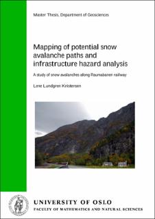
| dc.description | Mapping of potential snow avalanche paths and infrastructure hazard analysis | en_US |
| dc.description.abstract | The country of Norway has a topography and climate that facilitates snow avalanche production, especially in its northern and western parts. There is a need for extended snow avalanche mapping in areas with known avalanche activity. Increasing the knowledge and understanding of snow avalanches is an important factor for a successful land-use planning in avalanche-prone areas. In addition, more snow avalanche expertise is a prerequisite for a more detailed snow avalanche warning service. This study provides an analysis of the snow avalanche hazard along an avalanche-prone section of Raumabanen railway in Møre and Romsdal in Western Norway. The study area constitutes 57 kilometres of railway; from Bjorli in the East to Åndalsnes in the West. There are 20 known potential snow avalanche paths in the study area, of which nine are included in this study. Local snow avalanche history, topography and climate form the basis for this study, together with the use of the alpha-beta model, a statistical-topographic model used to evaluate maximum snow avalanche run-out distances. The main results from the snow avalanche hazard analysis gave that the annual frequencies for a snow avalanche reaching the railway vary between 1/8 and 1/32 at the different avalanche paths. Probability analyses showed that the total probability for a snow avalanche reaching Raumabanen equals 0,319/year for the whole study area. | en_US |
| dc.language.iso | eng | en_US |
| dc.publisher | Statens vegvesen | en_US |
| dc.rights | Attribution-NonCommercial-NoDerivatives 4.0 Internasjonal | * |
| dc.rights.uri | http://creativecommons.org/licenses/by-nc-nd/4.0/deed.no | * |
| dc.subject | Snow avalanche, | en_US |
| dc.subject | hazard analysis, | en_US |
| dc.subject | avalanche mapping, | en_US |
| dc.subject | the alpha-beta model, | en_US |
| dc.subject | infrastructure | en_US |
| dc.title | Mapping of potential snow avalanche paths and infrastructure hazard analysis | en_US |
| dc.type | Master thesis | en_US |
| dc.source.pagenumber | 98 | en_US |

